

1.Key Laboratory of Digital Earth, Aerospace Information Research Institute, Chinese Academy of Sciences, Beijing 100094, China
2.International Research Center of Big Data for Sustainable Development Goals, Beijing 100094, China
3.University of Chinese Academy of Sciences, Beijing 100049, China
4.China University of Geosciences (Beijing), Beijing 100083, China
Summary:
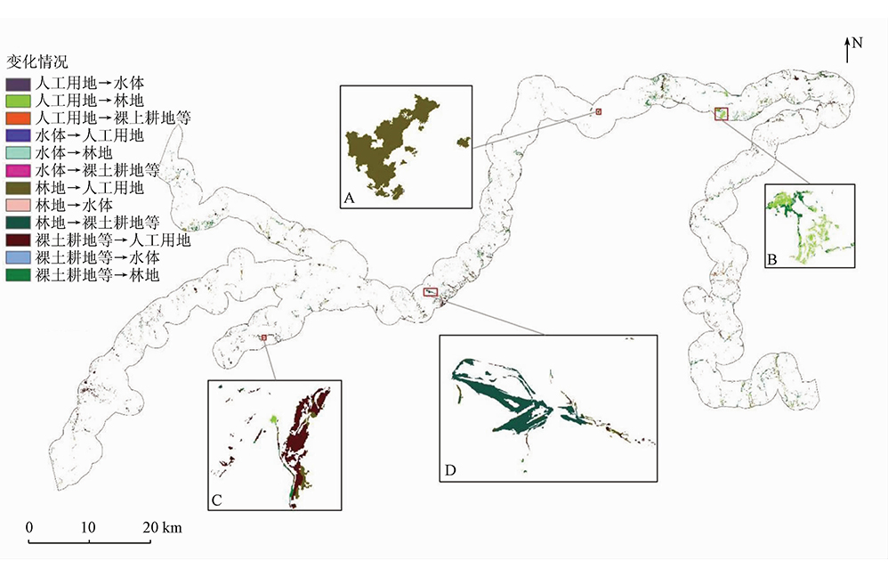
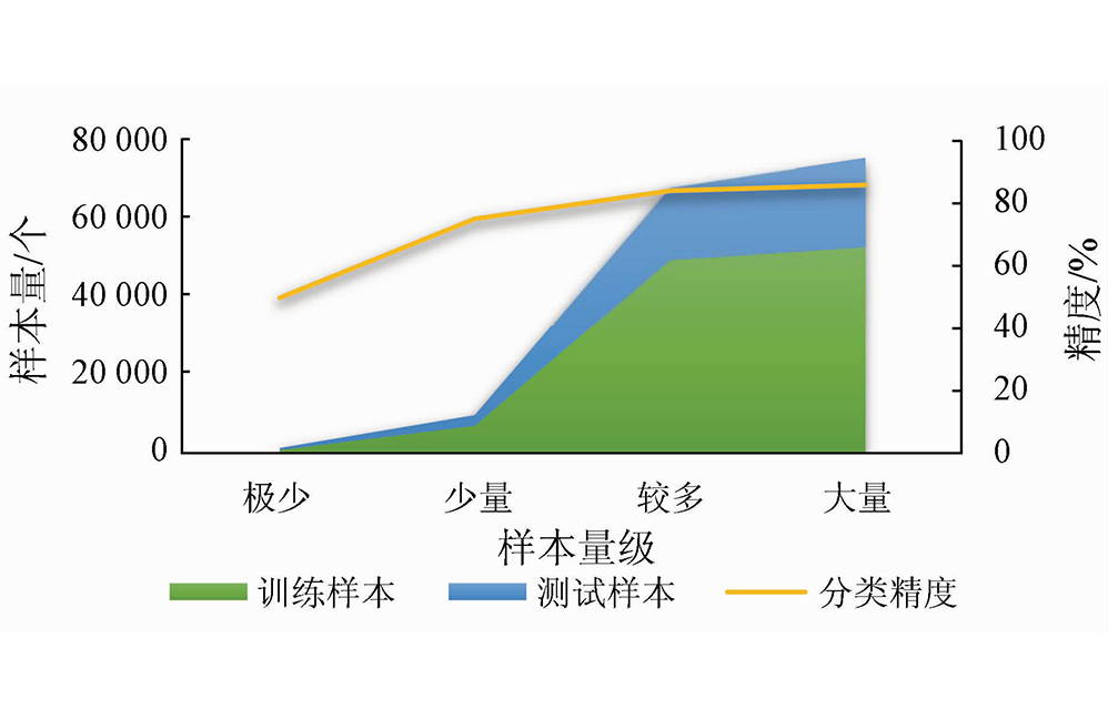
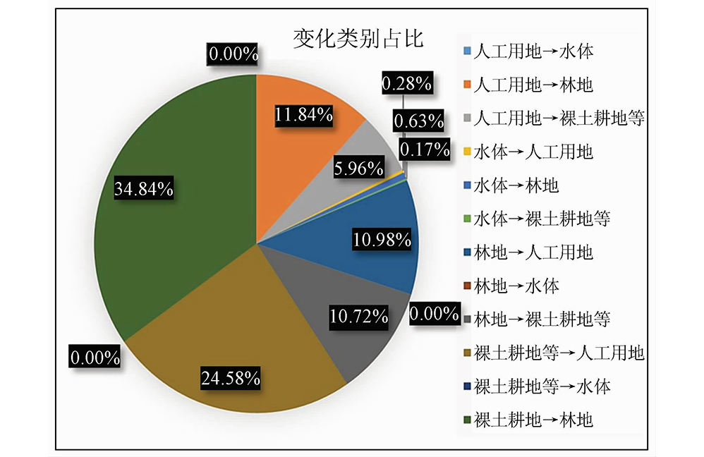
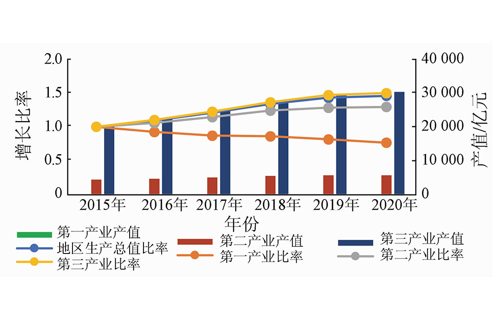
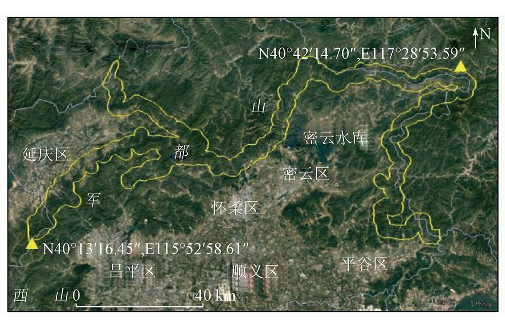
The coordinated economic and ecological development and the cultural landscape preservation of the Great Wall cultural zone are crucial for regional social sustainability. To meet the need for integrated monitoring and evaluation of large-scale linear cultural heritage, this study proposed a remote sensing dynamic monitoring method that integrates object-oriented change vector analysis and U-net deep learning. Based on the suppression of classified scattered noise and the accurate dynamic description of key regional environmental components, this study achieved the interpretation and information mining of the factors driving cultural landscape changes by combining socio-economic data and remote sensing change detection. Building on the 2-m-resolution GF-2 fused images from 2015 to 2020, the Beijing section of Ming Great Wall was examined through remote sensing change detection of surface elements and quantitative analysis of the land cover change matrix for its landscape corridor using methods including multiresolution segmentation, change vector analysis and extraction, and U-net image classification. The study reveals that the land cover along the Beijing section of Ming Great Wall cultural zone yielded a change rate of 0.098%, primarily manifested in the shift from bare land and farmland to forests and the growth of artificial land. Meanwhile, the ecological environment of the cultural zone exhibited positive development and an overall favorable protection state. The research results will provide technical support for the coordinated economic and ecological development and the sustainable preservation of the cultural landscape along the Beijing section of Ming Great Wall.


Remote Sensing for Natural Resources
Liu H W, Chen F L, Liao Y A. Remote sensing dynamic monitoring and driving factor analysis for the Beijing section of Ming Great Wall[J]. Remote Sensing for Natural Resources, 2023, 35(4): 255-263.
National Key Research and Development Program of China International Cooperation Key Project "Non-invasive assessment of cultural heritage vulnerability by spaceborne radar interferometry" (Grant No. 2017YFE0134400); National Key Research and Development Program of China Project "Research on natural disaster risk assessment and emergency response for immovable cultural relics" (Grant No. 2019YFC1520800)
Copyright © 2026 International Centre on Space Technologies for Natural and Cultural Heritage under the auspices of UNESCO.
Beijing ICP Filing No. 05002788-3


