The core mission of HIST is to promote space-based observation and understanding of World Heritage sites. Over nearly a decade of development, HIST has gradually established a comprehensive heritage conservation system encompassing archiving, protection, management, monitoring, and assessment. Integrated demonstration studies have been carried out at key sites such as Angkor Wat in Cambodia, the Grand Canal, and Bagan in Myanmar, paving the way for intelligent and holistic management solutions for a broader range of heritage sites.
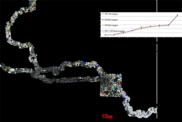
The Beijing section of the Grand Canal stretches 82 kilometers, spanning six districts. It features a high density of heritage sites of various grades, covering a wide historical span and diverse types, serving as the “leading section” of the Grand Canal Cultural Belt. Supported by a project funded by the Beijing Municipal Science and Technology Commission, we conducted high-precision 3D modeling and digital visualization of the existing heritage along the canal. Additionally, satellite remote sensing imagery was used to carry out comprehensive monitoring and analysis focusing on three aspects: water quality, landscape ecology, and surface micro-deformation.
The HIST research team conducted a study on the impacts of global change on giant panda habitats using spatial information technologies. The results show that although the giant panda habitats were struck by the Wenchuan and Ya’an earthquakes in recent years, with the Ya’an earthquake having a relatively minor impact and the Wenchuan earthquake causing more severe damage, vegetation in the affected areas showed significant natural recovery within three to five years.
However, the continuous impacts of climate change require close attention. In panda habitats, rising temperatures have caused an upward shift in the vertical vegetation zones in mountainous regions and a northward expansion in latitude. Combined with excessive human activities such as road construction, land reclamation, mining, and reservoir building, these factors have affected the suitability of panda habitats to varying degrees, with some areas even requiring consideration of migratory or translocation-based conservation strategies.
At the invitation of the APSARA National Authority, HIST signed a Memorandum of Understanding (MoU) with APSARA in June 2013 and subsequently established a joint research team. Using long-term, multi-source remote sensing data and various spatial analysis methods, the team conducted studies on the dynamic environmental changes around the Angkor heritage site, such as forests, water systems, and surface deformation, and their impacts on the monuments. This work has provided spatial technology support for the protection and sustainable development of the Angkor site, while also helping APSARA cultivate local technical experts in heritage protection through space technologies. To date, extensive research has been carried out on forest change, urban expansion, land subsidence, and lake monitoring, and the project outcomes have been highly recognized and commended by both the Cambodian government and UNESCO.
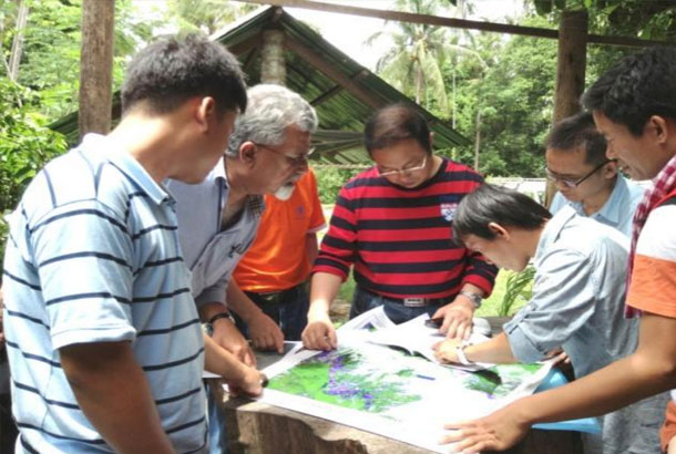
Between 2013 and 2015, HIST delegations visited the Angkor Heritage Site five times for scientific investigations and technical training. HIST researchers participated in three consecutive sessions of the International Coordinating Committee for the Safeguarding and Development of the Historic Site of Angkor (ICC) , including both the Technical Committee and the Plenary Session, where they presented reports highlighting the application of spatial information technologies in Angkor’s conservation. In September 2014, RADI, HIST, and APSARA jointly signed an agreement for the donation of a Virtual Satellite Ground Receiving Station System to the Angkor Heritage Site.
In February 2016, Bai Chunli, then President of the Chinese Academy of Sciences, visited the REAS project station. During the visit, Cambodian Deputy Prime Minister Sok An met with President Bai and expressed high appreciation for the “Remote Sensing of the Angkor Environment” project conducted by HIST, recommending the continuation of a second phase of cooperation.
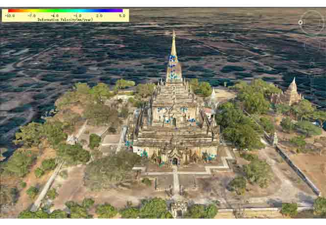
From 2018 to 2020, HIST and the Department of Archaeology and National Museum under the Ministry of Religious Affairs and Culture of Myanmar carried out active and close international cooperation and exchanges on the monitoring and conservation of the Bagan heritage site. The collaboration included six rounds of mutual visits and field investigations involving nearly 30 person-times. A series of remote sensing–based thematic products were developed, including DSM products at a scale of 1:2000, ultra-high-resolution 10 cm orthophoto images, UAV photogrammetry data of pagodas, and 3D models of the monuments.
The project also established a trilingual (Chinese–Burmese–English) IoT-based pagoda monitoring system, digitally reconstructed the historical footprints of the Southern Silk Road connecting China and Myanmar, and assessed the impacts of current natural processes and human activities on key cultural heritage sites along the route, particularly in Bagan.
Copyright © 2026 International Centre on Space Technologies for Natural and Cultural Heritage under the auspices of UNESCO.
Beijing ICP Filing No. 05002788-3