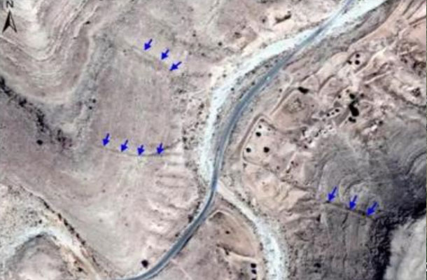
Discovery of Archaeological Sites by Remote Sensing for the First Time along the Silk Road; Ten Discovered Sites in Southern Tunisia; Field Verification of the Site of a Retaining Dam.
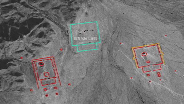
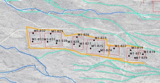
Since 2017, the HIST research team has worked closely with the Ningxia Institute of Cultural Relics and Archaeology in the study of the Xixia Imperial Tombs. By comprehensively applying remote sensing, environmental archaeology, and multidisciplinary analytical methods, the team identified additional satellite tombs and potential imperial tombs, providing strong support for archaeological excavations. In 2024, the HIST team conducted a systematic study of the ancient flood-control engineering system of the Xixia Imperial Tombs, discovering 31 new ancient hydraulic remains. They also developped a framework for archaeological site detection and assessment based on satellite data, which enabled the intelligent mapping of archaeological sites within the mausoleum area. These achievements have provided crucial scientific evidence and technological support for the successful nomination of the Xixia Imperial Tombs as a UNESCO World Cultural Heritage Site.


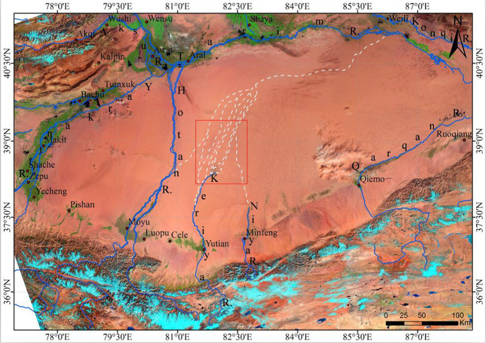
Based on multi-source remote sensing data and supplemented by ancient maps, historical records, and archaeological reports, the project focuses on Milan, a key town along the southern Silk Road, and conducts spatial archaeological research on its irrigation and reclamation system. The irrigation canal remains of the Milan reclamation area were automatically extracted, and the main cultivated area of the Han Dynasty Milan reclamation zone was estimated to be about 80 square kilometers.
Using the “patch-corridor-matrix” model, the project analyzes the structural characteristics of the Milan reclamation landscape and further discusses the roles and features of different reclamation landscape elements within the coupled “mountain-desert-oasis” system.
This research reveals the fundamental model of the Han Dynasty’s irrigation and water diversion system used for agricultural reclamation in the Western Regions, laying a scientific foundation for further exploration of the military, historical-geographical, cultural, economic, and geopolitical significance of the two-thousand-year policy of frontier reclamation and defense in Xinjiang.
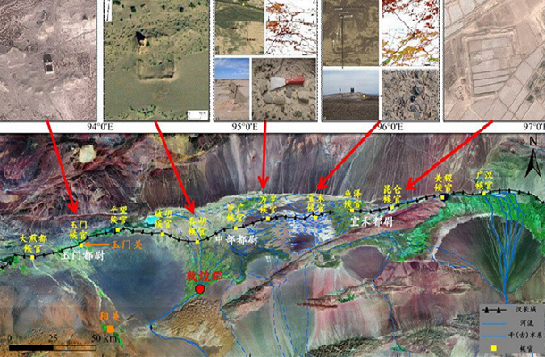
Using remote sensing, GIS, and GPS technologies, combined with ground survey data and historical sources, the project discovered and verified two ancient city sites associated with the Han Great Wall defense system. From the perspective of space archeology, it systematically analyzes the spatial defense structure of the Han Great Wall in the Dunhuang region, and produces thematic remote sensing maps illustrating the spatial organization of the Han Dynasty Dunhuang Commandery’s defense system and the distribution of frontier garrisons.
The results offer important academic evidence and scientific insights for a more nuanced understanding of the Han Great Wall defense network in the Hexi Corridor, as well as ancient frontier development strategies, the evolution of oases and Silk Road routes, and broader regional environmental changes.
Under the overall framework of intergovernmental cooperation between China and Italy, and in response to China’s strategic needs for the “the Silk Road Economic Belt”, the bilateral international cooperation project titled “Intelligent Management and Pilot Application of Sino-Italian Cultural Heritage Sites Based on Earth Observation”, jointly led by HIST (International Centre on Space Technologies for Natural and Cultural Heritage under the auspices of UNESCO) and the Institute for Archaeological and Monumental Heritage of the Italian National Research Council (CNR), was implemented from 2013 to 2015.
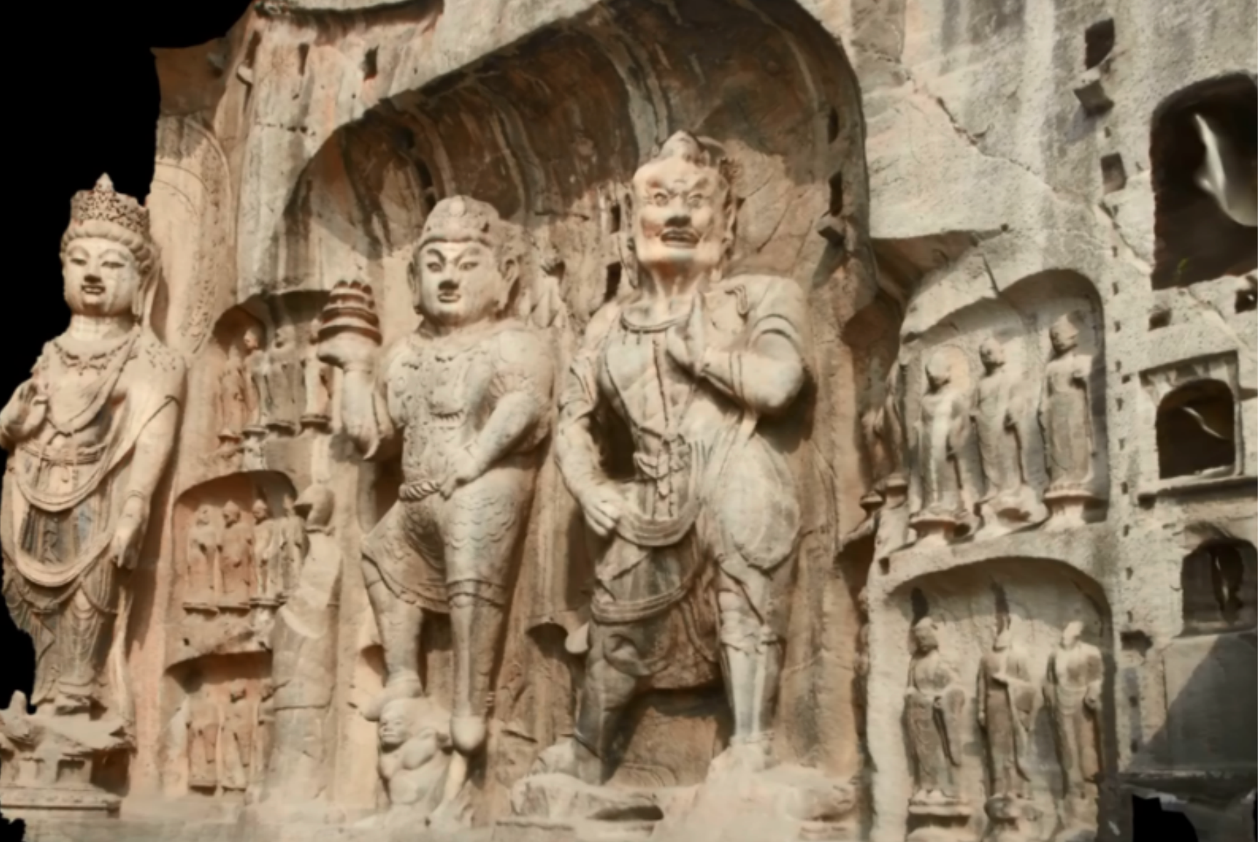
Representative achievements include: conducting space archaeology research that integrated satellite, aerial, and ground-based observations on several sites along the Silk Road within the ancient city of Luoyang—such as Xin’an Hangu Pass, the Han-Wei Capital City, and the Dingding Gate ruins; proposing radar image interpretation indicators (shadow, vegetation, and soil signatures) applicable to remote sensing archaeology; using unmanned aerial vehicle (UAV) imaging and 3D scene modeling for the Dingding Gate ruins; and carrying out geophysical prospecting experiments at the site.
These efforts demonstrated the potential and effectiveness of geophysical technologies in remote sensing archaeology across the Central Plains of China.
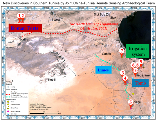
On April 19, 2018, HIST’s Space Archeology Research Team, in collaboration with scientists from Tunisia, Italy, and Pakistan, applied advanced spatial archaeological technologies and methods to discover ten ancient Roman archaeological sites in Tunisia, located at the western end of the ancient Maritime Silk Road. This marked the first time Chinese scientists identified archaeological sites abroad using remote sensing technology, filling a significant gap in spatial archaeological research on Tunisia’s cultural heritage.
The discovery was highly acclaimed by both Chinese and Tunisian representatives, including Bai Chunli, then-President of the Chinese Academy of Sciences, and Mohamed Zin Alabidin, the Tunisian Minister of Culture. In March 2019, the project was recognized as one of “Ten Great Events of China Remote Sensing in 2018.”
Copyright © 2026 International Centre on Space Technologies for Natural and Cultural Heritage under the auspices of UNESCO.
Beijing ICP Filing No. 05002788-3