Digital Mapping and Preventive Conservation of the Ming Great Wall Post-Earthquake Recovery and Sustainable Development of the Jiuzhaigou World Heritage Site Satellite Remote Sensing Monitoring of World Heritage Sites in Syria after Local Conflicts Heritage Management.
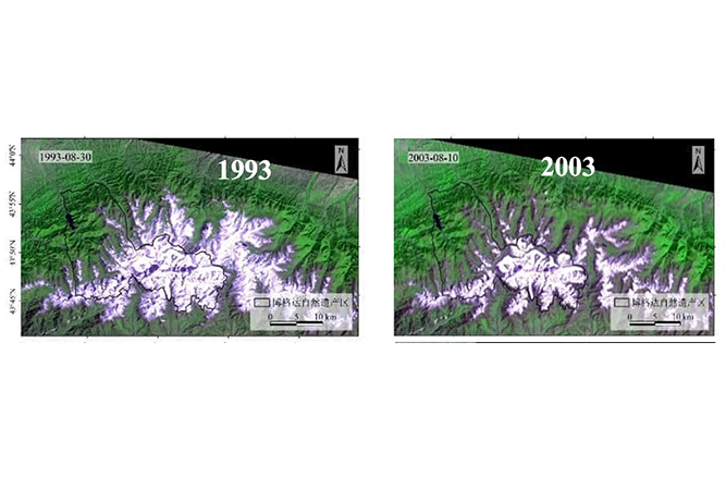
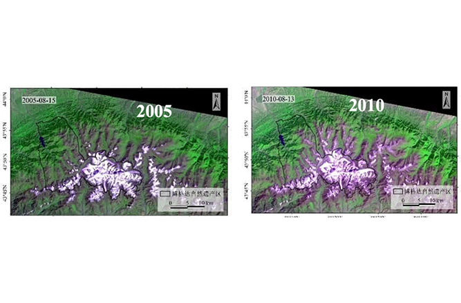
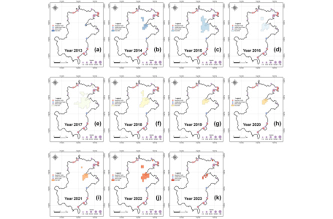
HIST conducted a spatial monitoring and assessment on the Bogda Biosphere Reserve in the Tianshan Mountains of China and its surrounding regions using precise spatio-temporal image data collected and analyzed from 1993 to 2024. This study provided scientific evidence of glacial retreat and generated crucial data support for understanding climate change impacts on mountain biosphere reserves, as well as for mountain conservation policies.
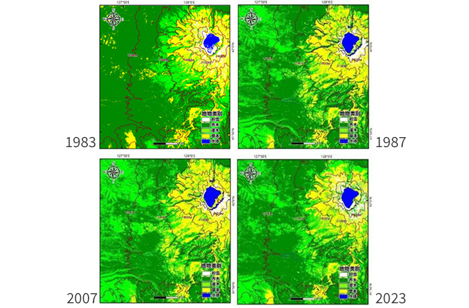
HIST utilized remote sensing data combined with Support Vector Machine (SVM) land cover classification and Fractional Vegetation Cover (FVC) inversion, to assess vegetation recovery patterns in Changbaishan Biosphere Reserve in China after the 1986 typhoon. This research informed disaster response strategies in mountain ecosystems through analysis of vegetation succession patterns at different elevation ranges over 40 years (1983-2023).
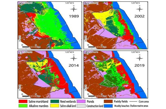
HIST utilized multi-temporal remote sensing imagery (Landsat TM and Sentinel-2 data from 1989-2019) and spatial analysis methods to assess landscape dynamics, coastal erosion patterns, and their impacts on habitats of rare endemic species such as red-crowned cranes at the Yancheng Biosphere Reserve in China. The project informed ecological restoration strategies such as seasonal reed harvesting and high-quality construction of the Tiaozini Reserve, significantly enhancing waterbird habitat network connectivity.
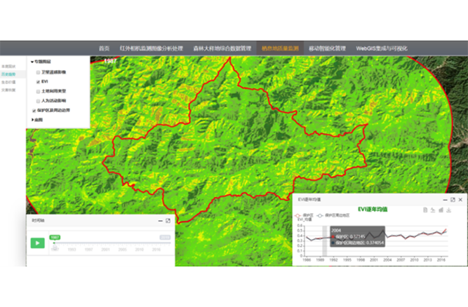
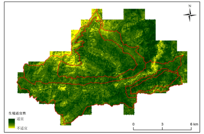
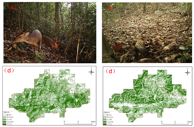
HIST established the first integrated monitoring system along the Nanling Mountain Range of China by combining infrared camera networks, multi-source satellite remote sensing, and dynamic assessment. The project achieved 10-meter-resolution habitat assessment, recorded 800,000 wildlife images with detected peaks in domestic animal activities (2023), and quantified forest coverage increase from 92% (1987) to 98% (2024) and 0.15 EVI index improvement.
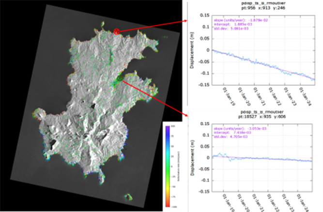
HIST employed multi-source satellite remote sensing (Sentinel-1 SAR, VIIRS night lights, CMIP6 models) and InSAR to monitor coastal dynamics (2017-2024), land subsidence (mm-level accuracy), light pollution impacts, and sea-level rise risks in Island of Príncipe Biosphere Reserve, identifying erosion threats to the island’s beaches, inundation risk for Santo António by 2100, and disruptions of green turtle nesting due to light pollution. These findings directly informed conservation planning and climate adaptation strategies, and were presented to São Tomé and Príncipe national authorities including Prime Minister, Ministers of Environment and Technology, and President of Príncipe Island.
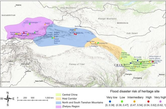
HIST proposed a dynamic risk monitoring and risk assessment technology. Findings suggest that heritage sites along the Silk Road are generally in good condition. However, the substantial increase of built-up areas can pose challenges to heritage conservation. This study highlights the importance of preserving vegetation coverage and water diversion measures to prevent floods.
HIST compiled the Remote Sensing Monitoring and Analysis Report on Endangered African World Natural Heritage Sites. By integrating remote sensing technologies with landscape ecological analysis methods, the report provides a comprehensive assessment of the conservation status of endangered World Heritage sites across multiple African countries. The study systematically analyzes the combined impacts of poaching and illegal wildlife trade, illicit mining and resource extraction, large-scale deforestation, climate change, armed conflicts, and agricultural expansion on heritage site ecosystems. It reveals the complex challenges and sustainable development opportunities faced by numerous natural heritage sites amid intensified mining activities and recurrent armed conflicts.
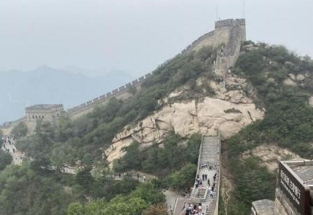
The integrated “Space-to-Ground” Earth observation technology provides firsthand scientific data for the macro-scale observation, value presentation, dynamic monitoring, and preventive conservation of the linear heritage of the Ming Great Wall. Meanwhile, geospatial big data technologies enriched by socio-economic information offer new perspectives for the sustainable development and utilization of the Great Wall’s resources, including disease detection and risk assessment.
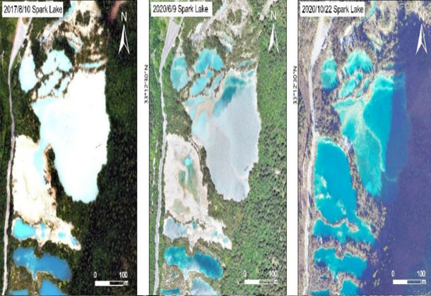
After the Ms 7.0 earthquake struck Jiuzhaigou in 2017, HIST, commissioned by the Jiuzhaigou World Heritage Administration, carried out an integrated “Space-to-Ground” monitoring and assessment of landslide hazards and vegetation recovery. The results show that between August 2017 and late 2020, the total area affected by landslides in Jiuzhaigou continued to expand, although the number of individual landslides decreased. During the 2020 rainy season, debris-flow activity was relatively intense; rainfall reactivated slope deposits left by co-seismic landslides, further enlarging the damaged areas and triggering new debris flows, while unstable mountain slopes remained at very high risk of further collapse. In contrast, monitoring indicated that landslide control efforts in stable zones had begun to show positive results, with the disappearance of small-scale collapse surfaces being the main reason for the reduction in the number of landslides.
The “Space-to-Ground” integrated spatial monitoring and assessment system has provided strong scientific support for Jiuzhaigou’s post-earthquake restoration and reconstruction management. It established a spatial information monitoring system to facilitate the recovery and conservation management of Jiuzhaigou’s interconnected mountain–water–forest–lake ecosystem, supplying essential scientific data and technical backing for the site’s post-disaster restoration, protection, and sustainable development.
Syria is home to six World Cultural Heritage sites — including the Ancient City of Damascus (inscribed in 1979), the Ancient City of Bosra (1980), the Site of Palmyra (1980), and the Ancient City of Aleppo (1986) — as well as twelve properties on Tentative List. Satellite-based monitoring and assessment indicate that since the outbreak of the Syrian civil war in 2011, all six World Heritage sites were inscribed on the List of World Heritage in Danger in 2013. The results of this evaluation provide essential scientific references for developing protection and management measures for Syrian heritage sites after the conflict and contribute to their sustainable development.
In this study, the Ancient City of Aleppo (a World Heritage site) and the Ancient City of Dura-Europos (a Tentative World Heritage site) were selected as case studies. Addressing key issues such as war-related destruction and illegal excavations during the Syrian conflict, multi-source high-resolution satellite imagery and digital image processing techniques were used to monitor and assess changes before and after the war. The results reveal that the Ancient City of Aleppo suffered severe damage from the conflict, with major historical structures — including the Citadel of Aleppo and the Great Mosque of Aleppo — being destroyed to varying degrees. After 2015, certain protective and restoration efforts were initiated. In contrast, the site of Dura-Europos has been almost completely defaced due to extensive looting and illegal excavations, leaving countless looting pits visible on the ground, and its conservation situation remains extremely critical.
HIST signed a cooperation agreement with the World Heritage Centre and, with the support of the Government of the Netherlands through its Trust Fund, conducted a scientific study based on multi-source satellite data from 2001 to 2015 and high-resolution data from 2015. The HIST research team analyzed land cover across Rennell Island—particularly in West Rennell—and assessed changes in vegetation coverage from 2001 to 2015, further predicting the dynamic trends of vegetation coverage in the coming years.
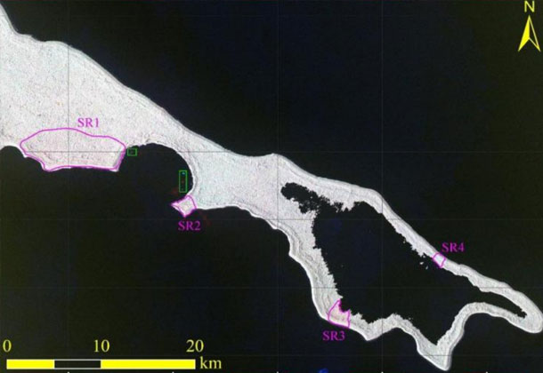
The remote sensing data objectively showed that large-scale deforestation had threatened the ecological integrity of the East Rennell World Heritage Site, leading to its inscription on UNESCO’s List of World Heritage in Danger in 2013. By applying space technology, the project monitored vegetation cover changes over the past 15 years in the endangered World Heritage site located in the South Pacific’s Solomon Islands. Furthermore, remote sensing monitoring following Tropical Cyclone Harold in April 2020 showed that the cyclone had only a limited impact on the area.
On June 16, 2014, Professor Guo Huadong, Director of HIST, and Dr. Sanath Panawennage, Director General of the Arthur C. Clarke Institute for Modern Technology (ACCIMT) in Sri Lanka, signed a Memorandum of Understanding on Cooperation at the ACCIMT headquarters in Colombo. From 2019 to 2020, the HIST research team conducted an analysis of ecological and environmental changes in elephant habitats across Sri Lanka using multi-source satellite remote sensing data. The study examined variations in land use, habitat fragmentation, and habitat quality. In 2020, HIST extended this research to monitor and analyze forest loss across Asian elephant habitats throughout the region, assessing forest loss areas, loss ratios, and driving factors. The study provided an updated, high-resolution, and long-term dataset describing recent forest loss in protected habitats, laying a scientific foundation for future habitat conservation, ecosystem restoration, and the recovery of wild elephant populations. These findings will contribute significantly to the sustainable management of Asian elephant habitats in the years to come.
Copyright © 2026 International Centre on Space Technologies for Natural and Cultural Heritage under the auspices of UNESCO.
Beijing ICP Filing No. 05002788-3